A True Revolution
in Forensic Scene Visualization & Documentation
Visual Law provides its clients with a wide variety of new technologies that have revolutionized the art and science of forensic scene visualization. Never before have we had the ability to capture a collision site or crime scene in such detail in three dimensions so that attorneys and expert witnesses are able to take accurate measurements, define lines of sight and reconstruct events without leaving the office.
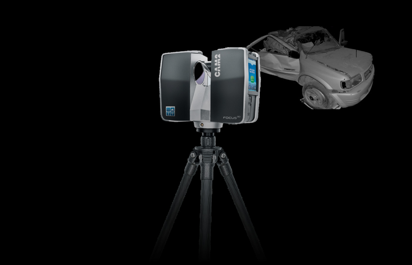
Laser Scanning
Services
We use state of the art terrestrial laser scanners to capture complete exterior scenes, buildings, vehicles and critical objects. Visual Law has specialized in three-dimensional forensic visualization for over two decades and we have a long history of meeting the stringent requirements for evidentiary foundation in both State and Federal courts. Thus, we both evaluate and test all the technology we use with the assumption that everything we do will be tested and challenged at trial.
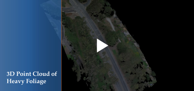
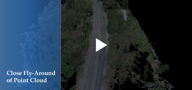
Laser scanning generates a point cloud that precisely defines a three-dimensional scene using millions (often hundreds of millions) of discrete points. These massive data sets require extreme computational processing resources to both create and manipulate. Thus, we specialize in reducing these monstrous collections of data into workable 3D scenes that can then be efficiently displayed on standard desktop, laptop and tablet devices.
We also provide our clients with customized programming for interactive presentations that allow counsel or witnesses to manipulate virtual objects or 3D scenes in real time. Visual Law specializes in data acquisition and forensic visualization so that our clients receive exactly what they need for each individual case or project.
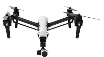
Aerial Drone
Mapping & Visualization
part 1
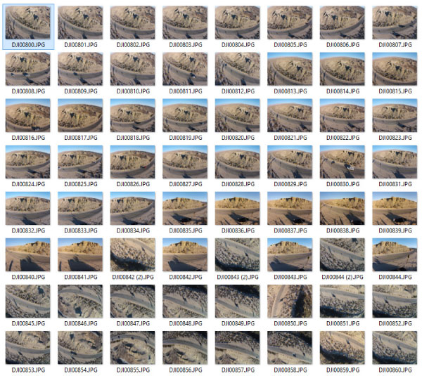
Visual Law works hard to stay at the forefront of data collection and 3D visualization. It would be difficult to exaggerate how rapidly the tools are developing in this field. Visual Law is nationally recognized for its leadership in 3D mapping and its work with ultra high resolution photogrammetry generated by unmanned aerial vehicles, or drones.
Visual Law partners with several major developers of this technology so that we are able to achieve results that other forensic companies are unable to deliver at any price. We have received rave reviews and enthusiastic endorsement from a number of engineering firms who contract with us to provide custom imagery and terrain data.
There are extraordinary advantages to this technology that many experienced engineers are unaware of. For instance, we can acquire imagery over a heavily travelled freeway and use sophisticated computer algorithms to produce images that remove all moving objects from the roadway. The result is an ultra-high resolution snapshot of the roadway without any traffic.

Ortho Imagery
Mapping & Visualization
part 2
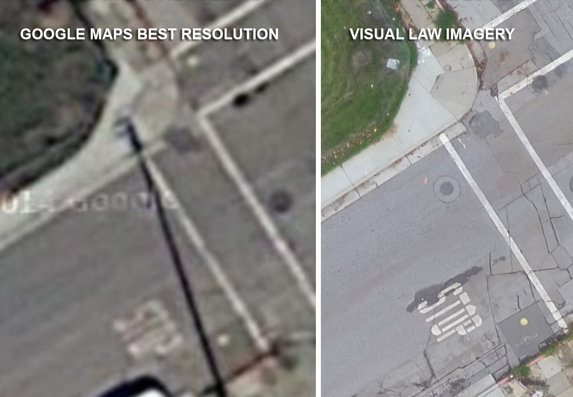
It is impossible to exaggerate how important high resolution ortho-imagery has become to our clients. Visual Law has commissioned and used aerial imagery for more than 20 years but only recently has photogrammetric software developed in conjunction with aerial drones to be able to create custom ultra-high resolution orthographic images. Unlike normal aerial photographs, orthographic aerials are actually sophisticated mosaics generated from hundreds of individual photographs taken by the drone. When processing is complete, the aerial image is absolutely accurate in scale with astonishing detail.
In the past, it has been necessary to commission a survey team with a total station to visit a site to acquire an accurate scale diagram to be used for accident reconstruction. The survey process, however, can never match the detail and accuracy of these orthographic mosaics. Roadway markings, tire skid marks, paint scrapes, debris and all other important landmarks are faithfully and accurately documented in the ortho-imagery. Moreover, it is not necessary to block off a scene or stop traffic to acquire the imagery you see here. As a tool, orthographic mosaics have revolutionized the documentation of collision scenes and have changed the way our clients are able to present a case to a jury.
Visual Law can fly a given location at different times to generate comparative images showing shadow positions or other temporal changes. In many instances it becomes very useful to examine a scene under different lighting or weather conditions.


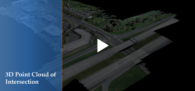
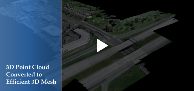
Ortho-Imagery Case Study
Documenting A Major Freeway Collision
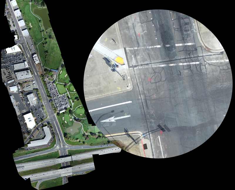
We recently worked on a project involving a multiple vehicle catastrophe that had been the focus of the California Highway Patrol's Major Accident Investigation Team (M.A.I.T.). Weeks before our client became involved, the M.A.I.T. crew had closed down the freeway to do extensive measurements and documentation of tire skid marks and pavement scrapes. In a single morning session (during rush hour to boot) Visual Law acquired 460 aerial images that we then processed to generate a survey-accurate scaled image of the empty freeway surface.
Our client was stunned with the quality and commented, "I'm not sure we could even do it, but if we could I can only imagine what it would have cost us to close down the freeway to get this information on the ground.
Photogrammetric Data
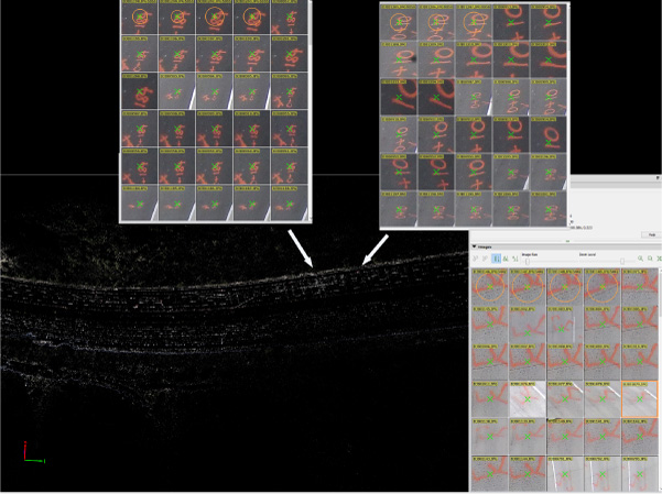
This is a screenshot taken from one of the computers processing photogrammetric data from the freeway drone flight. You can see how the software identifies the same landmark in multiple photographs. Once the computer identifies a particular object in more than three photos it will work out mathematically what the orientation of the object is in true space. Using brute force processing, the computer converts this information into a calibrated orthographic image as well as generating a 3D point cloud locating the object in 3D space.
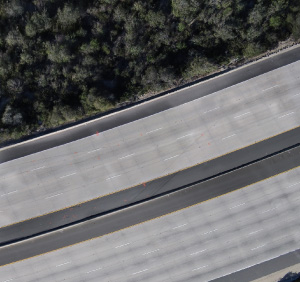
CHP Ortho Image
When the drone flew over this freeway it was in the middle of morning rush hour with all lanes full of moving traffic. The "magic" of photogrammetric processing of our drone footage allows us to generate an absolutely clean road surface upon which one can clearly see the evidence of not only vehicle skid marks, but also the spray-painted markings from the California Highway Patrol investigative team. Moreover, this ortho-image is survey-accurate. Our clients can use calipers to make measurements that are accurate to the inch over more than 1,500 feet of distance.
Visual Law Group
Silicon Valley Headquarters96 North Third Street Suite 500
San Jose, CA 95112
Telephone: 408-404-5000
www.Visual-law.com
info@visual-law.com